CF05 - Puente la Reina - Estella - 19,7 km
Itinerary
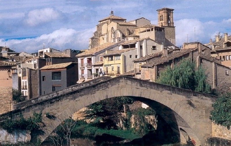
You will leave Puente la Reina by the Main Street, leading to the famous medieval bridge over the River Arga. After crossing the bridge, you will turn left and go through the N-111 to enter in the Borough of Zubiurrutia, also known as the Borough of the Nuns (“Convento de las Comendadoras del Espíritu Santo”). Then, you will arrive at Eunea village.
You will continue between the River Arga (to the left) and the national road (to the right), by a comfortable soil path, which further on turns into a sinuous and narrow lane in an uneven surface between hills and steep slopes.
Soon before arriving at Mañeru, the lane becomes a pilgrim road, a path parallel to the motorway. In Mañeru, you will keep going, leaving the village by Calle Forzosa. You will leave the cemetery on the left, from where you can see the village of Cirauqui, at the top, a few km away. The way to Cirauqui goes through vegetable patches and fruit trees, by a soil path.
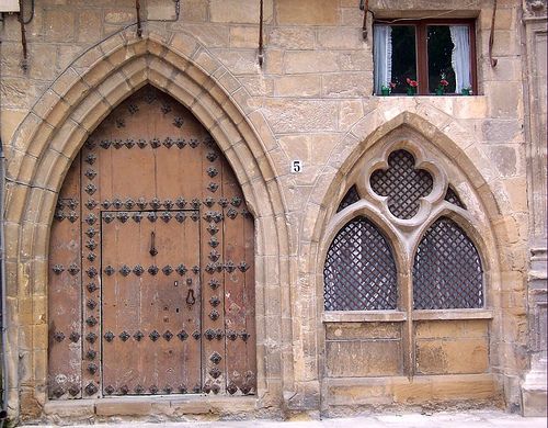
You will enter in the village though a beautiful pointed arch gate. You will have to go up to the peak of the village and, from there, descend a pronounced slope by a roman causeway, in the midst of cypresses. Finally, you will cross a half-ruined roman bridge over the canyon.
Crossing the national road, you will keep going, progressively separating from it, in the midst of labor fields by the old roman causeway. 1 km and a half away, you will go through the old site of Urbe, next to a peak. From there, you will go down a hillside to a little country house. Soon after, you will get to a road next to the diversion to the Alloz reservoir.
You will continue on this road for a while, turning left when passing by a modern aqueduct and an old mill. Crossing Río Salado (River Salty) by an old bridge, you will ascend by a path to the village of Lorca, after going through the N-111 by an underground walkway. You will leave Lorca by the N-111, following the road until passing the diversion to Lácar an Abárzuza, when you will turn left.
You will keep going to Villatuerta in the midst of paths and labor fields. When you arrive at the urban quarter of the village, you will go to Ermita de San Miguel (St. Michael’s Chapel). After crossing a road and the bridge over the River Ega, you will follow the way of Ordoiz and you will arrive at Estella.
External info sources about this route and recommended websites:
Federación Española de Asociaciones del Camino de Santiago
Very useful guide: Camino de Santiago. National Geographic
If you want to download any route in PDF format, you need to be registered. This is a very easy and free of charge process, and you will also enjoy other advantages.
To download a route in PDF format you must be registered , this is a simple and free process also enjoy other benefits.